A practical way to understand basic forecast terms, uncertainty, cones, watches, warnings, and local risk, but most advice is either too generic, too gear-focused, or too late.
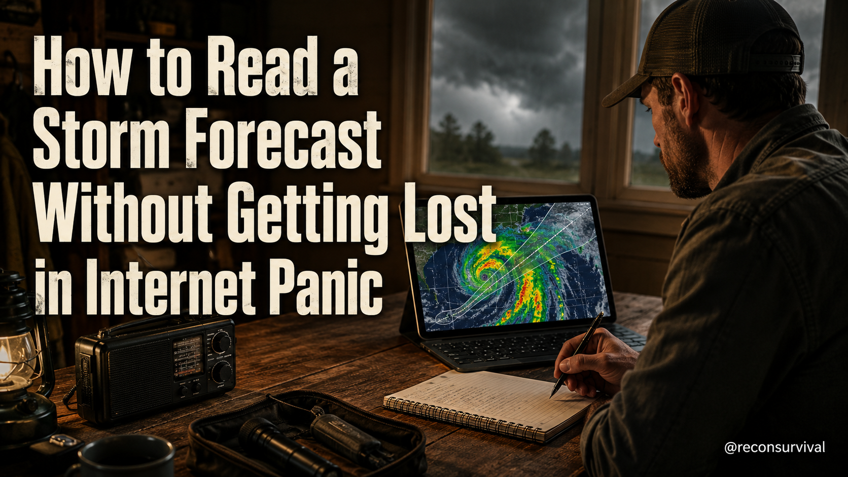
By the time a storm has a name, the most critical window for preparation has often closed. Most households react to headlines instead of data, letting anxiety drive their decisions while ignoring the specific terms used to describe their local threat level. This article solves that problem by giving you a calm, practical framework to read basic forecast terms, uncertainty, cones, watches, warnings, and local risk without getting lost in internet panic. You will leave with a clear system to assess your situation and act decisively.
Why Forecast Literacy Matters Before the Calendar Changes
Hurricane season officially begins in the Atlantic during early June, though tropical disturbances can occur earlier. This timing matters because it marks the first week of the annual risk cycle for coastal regions and the southern United States. There is no need for fearmongering; tropical cyclones are statistically rare in any single year, but the consequences of being caught unprepared for a rare event are severe. The real value of this lesson is understanding that forecasters are not trying to trick you; they are communicating probability and uncertainty using a standardized language.
When the internet floods with sensationalized headlines claiming a "monster storm" is coming, it is often because people are ignoring the technical definitions that separate a likely event from a hypothetical one. If you can distinguish between a Watch and a Warning, you stop wasting energy on unnecessary evacuation or panic, and you start focusing on securing your home and family. This literacy protects you from both complacency and overreaction.
The Common Mistake: Reacting to Headlines Instead of Data
The most common mistake people make with this topic is assuming that every piece of news constitutes an immediate threat to their specific location. Many readers see a map showing a storm 1,000 miles away and immediately begin packing bags or hoarding supplies. Others, conversely, scroll past warnings because they believe the news is exaggerated. Both extremes are dangerous.
The mistake is treating the forecast as a story rather than a technical document. People focus on the emotional weight of the headline – "Major Hurricane Approaches" – while ignoring the small print regarding probability, track errors, and the specific zones of impact. This leads to decision fatigue. By the time the storm actually impacts your neighborhood, you have already made decisions based on fear rather than local data. To fix this, you must adopt a system that separates the noise of the internet from the signal of the official forecast.
The Recon Survival Practical System for Forecasts
Recon Survival uses a practical system designed to turn confusing meteorological jargon into clear household actions. This system focuses on three pillars: identifying the event type, understanding the uncertainty margin, and verifying local risk through official channels. It relies on the guidance of the National Weather Service (NWS) and local emergency management agencies.
Our approach treats a forecast as a probability model, not a prophecy. We acknowledge that models have margins of error, especially for wind fields and rainfall totals. Therefore, the system prioritizes "worst-case scenario" planning for the cone of uncertainty, rather than betting on the most likely path. This mindset ensures that if the storm deviates slightly to the right, your family is still safe because you prepared for the full width of the potential threat.
Step-by-Step: Decoding Terms, Cones, and Warnings
To use this system, a normal household must understand and apply the following steps in order. These steps replace the need for complex gear or advanced meteorology degrees.
Step 1: Identify the Event Status. Always start by checking the NWS website or local emergency management site to see if an Advisory, Watch, or Warning is active for your county. An Advisory is for lower-level threats. A Watch means conditions are favorable for a severe weather event; prepare now. A Warning means the event is happening or imminent; take immediate protective action.
Step 2: Analyze the Cone of Uncertainty. You will see a cone shape on the map expanding over days. Do not treat the edge of the cone as a boundary between safety and danger. The cone represents the 60-70% chance of track error. For your family safety, plan as if the storm is anywhere within that cone. If your home is within 50 miles of the cone's edge, assume you could be on the path. If the cone passes far to the north or south, but your home is still within the "Risk Zone" defined by wind and rain estimates, you may need to prepare for secondary effects like flooding.
Step 3: Verify Local Risk. The national forecast gives the big picture, but local risk is what determines your action. Check the specific flood watches and wind speed estimates for your ZIP code. Flood warnings often lag behind warnings for high winds. If you are in a flood plain, a heavy rain forecast anywhere upstream is a direct threat to you, regardless of the storm's center location.
A Safe Beginner Practice Drill
You do not need to wait for a storm to practice reading forecasts. You can use a calm, safe drill to build your intuition and avoid panic when the real news hits. This drill requires only a notebook, a pen, and a computer or phone with internet access.
Perform this drill once a week when a tropical disturbance or storm is tracking near the continent. Sit at a quiet table with your family or a friend. Grab the official NWS map for your area. Read the forecast text provided by the weather service. Write down exactly what the definitions of "Watch" and "Warning" mean in your own words. Then, draw the cone of uncertainty on a piece of paper and place a pin where your house is. Ask your family members: "If we treated the edge of this cone as the danger line, would we need to pack our bag today?" Write down your answer and the reason behind it.
This exercise removes the emotional charge from the information. When you see the storm name in the news later, you will be able to recognize the terms immediately and filter out the panic-inducing content. This practice builds the mental muscle to remain calm during the critical first week of hurricane season.
How to Measure Skill Improvement
How do you know if this skill is actually improving? The metric is not how much you know, but how calmly you react. Track your response time and decision quality. Before you start this drill, you might spend ten minutes reading a forecast and still feel confused or overly worried. After several weeks of practice, you should be able to read a forecast in under two minutes and state clearly what needs to be done based on the official terms.
A secondary measure is your preparation list. If you consistently find yourself buying batteries or generators because of a headline, but later realize the storm will miss your area by a hundred miles, you are reacting to panic. If you can read a Warning and immediately execute your specific family plan without needing to call friends for reassurance, you have improved. The goal is to move from emotional reaction to procedural execution.
Recon Survival Principle
The Principle of Probabilistic Safety: In survival situations, you must plan for the probability, not the expectation. A storm can deviate from its most likely path at any moment. If you prepare only for the most likely path, you will be unprepared when the storm takes an unexpected turn. By understanding the full range of uncertainty in the forecast, you create a safety buffer that protects your family regardless of how the storm evolves.
Do Today
Today, you can apply this lesson immediately by taking concrete actions to improve your forecast literacy. Follow these seven steps to integrate this skill into your life right now.
- Bookmark the Official Sources: Go to the National Weather Service website for your specific region and bookmark the main forecast page. Ensure you can access it without clicking through to news portals.
- Review the Glossary: Read the definitions of Hurricane Watch, Hurricane Warning, Tropical Storm Watch, and Flood Warning on the NWS site. Write a single sentence explaining each in your own words.
- Map Your Risk Zone: Look at the latest forecast map for any active weather system. Pinpoint your home location relative to the cone of uncertainty. Decide today if your location falls within the area where you would take shelter or evacuate based on the official warnings.
- Audit Your Information Diet: Identify two news sources that rely heavily on sensationalized headlines and temporarily pause them during storm season. Replace them with official updates from local emergency management or the NWS.
- Update Your Family Plan: Ensure your family communication plan includes a step to check the official forecast terms. If a Warning is issued, have everyone know the specific shelter location or evacuation route without needing to research it under stress.
- Check Local Flood Zones: Verify your specific address against local flood risk maps. Understand that a storm might miss the landfall but still bring dangerous flooding to your specific neighborhood.
- Perform the Drill: Spend fifteen minutes today looking at a current forecast and writing down your family's action plan based strictly on the terms you read, ignoring the headlines.
You will no longer be a victim of internet panic or media noise. Instead, you will be an informed observer who can make calm, rational decisions that keep your family safe. This is the essence of fieldcraft applied to survival.